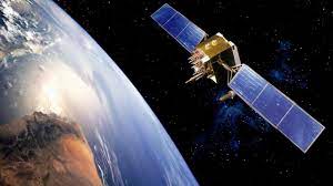
The Nigerian Airspace Management Agency and the Nigerian Civil Aviation Authority are collaborating with the Nigerian Communications Satellite Limited to expand satellite based navigation of aircraft to different destinations in Africa. Such collaboration will enhance safety and precision in flight operations, save funds for airlines and boost revenue of government agencies.
Last week the Nigerian Airspace Management Agency (NAMA), held demonstration and conference on Satellite Based Augmentation System (SBAS), which is a system that will provide satellite navigation and communication to pilots. For this to be possible, the pilots flying in Nigeria and other parts of Africa will depend on the satellite provided by NIGCOMSAT.
Migration of NAMA satellite based navigation to NIGCOMSAT satellite is not just to cover Nigeria’s airspace but the whole of African airspace and improve precision for landing and take-off for pilots.
NIGCOMSAT is a company under the supervision of the Federal Ministry of Communications and Digital Economy, responsible for the operation and management of Nigerian Communications Satellites.
The NIGCOMSAT was established on the 4th of April 2006 for the provision and oversight of Fixed Satellite Services (FSS) to its customers.
Over the years, it has provided wholesome satellite service to millions of Nigerians, but according to the officials of the agency, NIGCOMSAT has been underutilised over the years because the demand of its services has been largely for security, ease of communication and others, but it has the capacity to serve the whole of Africa and beyond.
NigComSat-1R was launched in 2011, after NIGCOMSAT-1, Nigeria’s first satellite was de-orbited due to technical reasons. The launch of NIGCOMSAT-1R, which was a replacement of NIGCOMSAT-1, was a huge accomplishment for Nigeria and this satellite could be used for demography, including the planning and mapping of population surveys, the mapping of census enumeration areas, the planning and monitoring of rural and urban growth, and the provision of early warnings for natural disasters like floods, earthquakes, volcanic eruptions and storms.
About SBAS
Satellite-Based Augmentation System (SBAS) is augmentation of a global navigation satellite system, which is a method of improving the navigation system’s attributes, such as precision, reliability, and availability, through the integration of external information into the calculation process.
According to Skybrary.aero, SBAS is a wide area differential Global Navigation Satellite System (GNSS) signal augmentation system which uses a number of geostationary satellites, able to cover vast areas, to broadcast primary GNSS data which has been provided with ranging, integrity and correction information by a network of SBAS ground stations. While the primary purpose of SBAS is to provide integrity assurance, use of the system also increases the accuracy and reduces position errors to less than one meter for pilots.
The system helps pilots and aircraft in many ways because SBAS improves the accuracy and reliability of GNSS information by correcting signal measurement errors and by providing information about the accuracy, integrity, continuity and availability of its signals. SBAS uses GNSS measurements taken by accurately located reference stations deployed across an entire continent.

NIGCOMSAT and PBN
The acting Managing Director of NAMA, Matthew Pwajok, explained during the SBAS flight demonstration at the Nnamdi Azikiwe International Airport, Abuja, that Satellite Based Augmentation System means pilots using satellite systems to be able to navigate their aircraft in the airspace.
Pwajok further explained that it would be using equipment not based on the ground to guide flights, but using satellite systems to navigate, which is akin to what NAMA had installed years ago, the Performance based Navigation (PBN). He however said with NIGCOMSAT satellite it would cover broader airspace, from Nigerian to regional airspace that can serve the African region and beyond.
“Some years ago, Nigeria implemented what we call performance based navigation, which is a satellite system for navigation and what it does is for you to use satellite base system with an aircraft equipped with performance system to navigate or to fly. When the aircraft uses that with ground procedures that are developed with flight procedure design, it enables it to manoeuvre, approach and land. It can also be used for en-route whereby you provide air routes, so that after takeoff it follows what we call a standard aircraft departure that is based on satellite still. That is using a satellite to develop manouvres for an aircraft for takeoff to climb to the en-route phase. When it reaches the en-route phase, when you have an air route based on satellite it continues with the same satellite system to also fly from one point to the other. So the satellite based navigation system covers all phase of flight,” Pwajok said.
He also explained that performance based navigation provides the pilot with lateral guidance and improves accuracy, the integrity, the availability and continuity of the signal for the pilot.
“So what is now required is to put a ground infrastructure, a monitoring system, a control system or a master station that receives signals from several satellites, triangulate them and take the best location or find a space induction or signal and now broadcast it through a broadcast media worldwide or globally and it will be reviewed by any aircraft that is flying within that vicinity and use it now for more precision. So, we have done performance base navigation that provides general lateral guidance for you to locate an airport. We now want to improve on it to do what we call precision approaches,” Pwajok further explained.
He disclosed that the system has been in use in Europe, the US and other parts of the world and Nigeria had embraced the system through NAMA performance based navigation but now wants to expand the system in collaboration with NIGCOMSAT.
Since the new satellite system from NIGCOMSAT covers the African airspace, NAMA is collaborating with Agency for Aerial Navigation Safety in Africa and Madagascar (ASECNA), which provides airspace management services to French speaking countries in West Africa and beyond, including 16.1 million square kilometres of airspace covering six Flight Information Regions – Antananarivo, Brazzaville, Dakar Oceanic and Terrestrial, Niamey and N’Djamena.
“Our sister agencies from ASECNA states are also here. Europe is here, America is here and so on. ICAO (International Civil Aviation Organisation). We are all going to monitor and see. When we are able to see, that this signal has transmitted, received, augmented and re-transmitted, it can guide aircraft precisely, an improved accuracy, an improved landing, approved takeoff and climb, then we will be able to now say yes, we can work towards implementation like the rest of the world. So it is a very important milestone, this satellite based navigation,” Pwajok
THISDAY also spoke to the Director of Operations, ASECNA, Bakienon Louis, who was in Abuja for the demonstration, who explained that he was in Nigeria for the demonstration of the capability of the navigation based on satellite in Africa.
“We have designed what we need for that to put in some ground stations a new satellite. And these signals coming from these stations will be found in all airports, you don’t need to have specific equipment on ground to use it. So this is the demonstration we all are going to do here to show the possibility in Africa, like what is on going in America and Europe. And at that time, you don’t need to implement ground equipment again.
He explained that NIGCOMSAT is providing the satellite, which would provide the signal for all Africa.
“The signal (from NIGCOMSAT) covers all Africa. It is geo satellite and it is only the payload on the satellite, which connects all the continents. That is why we are making this demonstration with NAMA and NIGCOMSAT. NAMA provides the air traffic services and NIGCOMSAT provides the satellite. They are hosting the payload, which provides the signal for Africa. NAMA will use the signal, which comes from this satellite,” the Director of Dakar-based ASECNA said.
He also explained about the importance of the signal.
According to him, “The signal is everywhere in all countries. Now what is needed for Africa, what we are doing today is a joint partner between Nigeria and some countries of ASECNA. They will own the signal; we have other countries coming inside to be partner of this to own the signal and then the signal will be provided to everybody. We think it can be an African body like African Union which can govern this signal for all the countries.”
SAATM
Aviation industry experts believe that the Single Africa Air Transport Market (SAATM), will significantly be enhanced by the SBAS project, using Nigeria’s NIGCOMSAT.
SAATM is a project of the African Union to create a single market for air transport in Africa. Once completely in force, the single market is supposed to allow significant freedom of air transport in Africa, advancing the AU’s Agenda 2063.
So without ground equipment, aircraft will operate seamlessly from one border to another relying on the satellite propelled SBAS throughout the African continent so it will enhance the realisation of SAATM. Pwajok also emphasised that the project would be of immense support to SAATM because it would remove barriers to enhance seamless flights across African airspace.
“Yes, we are talking about a single African air transport market. It must be supported by a single African sky. So the single African sky will be a strategy for sustaining or supporting the implementation of the SAATM. So definitely, if you want to remove barriers in terms of immigrations and whatever, then you also must remove barriers in the airspace, otherwise you have not achieved anything,” Pwajok said.
Speaking on behalf of Airline Operators of Nigeria (AON), the Chairman and CEO of Air Peace and the Vice-President of AON, Allen Onyema, said during the conference that SBAS would be very good for airlines in Nigeria and promised they would key into it by equipping their aircraft with corresponding facilities to take advantage of the new system. However, he said that for SAATM to work there must be fairness in its implementation.

“SAATM is very good idea that would help Africa, it would help connectivity, it would boost tourism. However, nation’s must be sincere in the implementation of the SAATM. I want to use this opportunity to tell everyone present that we must be sincere in our implementation of SAATM for all this to be enjoyed by everyone. If it is one sided, where Nigerian airlines are being deprived of landing permit or when given in in the other part of Africa, they make it very impossible for them to operate, then the objective of SAATM is defeated.
“But we have to support it but be sincere in its application. Flying over francophone countries have become something of a nightmare to Nigerian airlines, when they bring bills you start wondering how it happened. Sometimes there is a lot of conflict, then it goes to blackmail, and they do not accept reconciliation,” Onyema said.
Savings for Airlines
The Director General of the Nigerian Civil Aviation Authority (NCAA), Captain Musa Nuhu, disclosed during the conference that SBAS would save domestic airlines huge revenue because the new system will reduce flight time to destinations which would save them fuel burnt on the routes as they stick to the satellite based communication system.
The Director General said that SBAS could save the airlines 200-300 litres of fuel in one flight, which could save them a quarter of a million Naira, judging from the current high cost of aviation fuel and stressed that every litre of fuel saved for the airline by the new system means a lot to the operators.
“Today, we assemble in Abuja to share insights and progress made on the African continent with SBAS flight demonstrations in order to encourage stakeholders to accept and adopt SBAS technology in line with the strategy for the introduction of GNSS services in the AFI (Africa and Indian Ocean) Region. SBAS technology allows for the coverage of very wide sections of airspace and locations that were previously overlooked by terrestrial-based navigation aids. In many circumstances, it also provides more capacity, flexibility, and cost-effective navigation alternatives than older ground-based navigation aids. SBAS is an important component of Performance Based Navigation (PBN),” Nuhu said.
With this new duty by NIGCOMSAT, Nigeria has reinforced its reckoning in Africa and in the world.


